A world-renowned long distance path
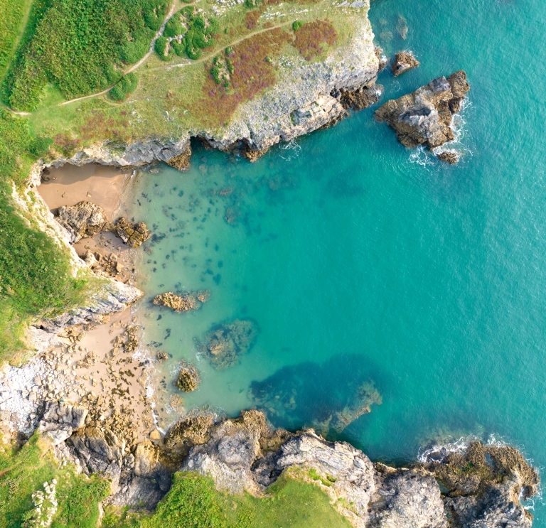
They used to call Pembrokeshire ‘Gwlad Hud a Lledrith’, the ‘Land of Mystery and Enchantment’. It has certainly worked its magic recently. In 2012 National Geographic magazine named Pembrokeshire the world’s second-best coastal destination. The year before, it ranked the Pembrokeshire Coast Path second in a world’s top 10 long-distance paths.
Of course, we knew that even before the route opened in 1970. Eighty-five per cent of its 186 miles runs through Britain’s only truly coastal National Park; a landscape built of rugged coast and golden beach, and backed by rolling hill and low mountain.

A walk through history
Yet the coast path is a walk through history as much as scenery. Hike the lot over two weeks and you’ll discover Neolithic tombs on St Davids Head, mighty castles at Manorbier and Pembroke and tiny Celtic chapels near Bosherston. You’ll see splendid small towns like Tenby and picture-perfect fishing villages like Solva and Little Haven. You’ll also see wildlife everywhere: astounding birdlife, probably seals, perhaps a dolphin.
To help plan your walk, read our tips on Planning a Wales Coast Path walk by guide book author Paddy Dillon, or find out how author Vivienne Crow got on Walking Pembrokeshire's 186-mile National Trail.


Four of our favourite walks
Perhaps the real joy of this coast, however, is that a carefully-chosen mile walk will reveal the magic that wowed National Geographic. There are over 200 short walks to select, from one mile to one day, and seasonal shuttle buses solve the logistics of one-way routes. Why not stay overnight and discover new views on your return?
To get you started here are four of our favourite walks on the famous Pembrokeshire Coast Path.
Cemaes Head, 5 miles
The Cemaes Head walk near Poppit Sands is lovely to do in springtime: you'll see fulmars, cormorants and guillemots nesting on the highest cliffs (550ft) in the National Park. More seals breed here than anywhere else in Wales from mid-summer. And year round you’re likely to spot chough, ravens, kestrels and buzzards, you may even see bottlenose dolphins in the bay.

Porthgain to Whitesands, 10 miles
Embark on this walk from pretty Porthgain harbour for exhilarating hiking along high cliffs. You’ll see spectacular views to rocky bays, a ruined settlement at Abereiddi beach, with its Neolithic burial chambers and views to Ramsey Island, before a paddle at Whitesands beach.

Stackpole, 6-mile circuit
The Stackpole wildlife walk that’s as good as it gets for families: a pretty harbour at Stackpole Quay, beautiful Barafundle Bay and Broad Haven south beach, plus Bosherston lily ponds (best in June) as an unexpected bonus.


Deer Park to Dale, 12 miles
This walk near Marloes is a superb day: a wave-lashed headland with an Iron Age hillfort and views to Skomer Island clouded by seabirds. Or use it to launch a day's walk around the Dale Peninsula: around St Ann’s Head there’s raw Atlantic on one side, calm estuary on the other and a straight walk back to Dale, where you can grab a well-deserved drink at The Griffin.


Useful information
- To help plan your trip take a look at our handy Wales Coast Path guide.
- Download the Wales Coast Path app - there's plenty of information on there that you won’t find on maps.
- Download the Wales Coast Explorer app - it helps you identify wildlife, flora, explore heritage sites along the way, and record your findings.
- Before you head out, please read our safety advice for exploring Wales' National Parks and safety tips for staying safe on the Welsh coast.
- Adventure Smart Wales has plenty of advice on how to ‘make a good day better’, and we recommend you read it before planning your days out.
- Traveline Cymru is a useful public transport journey planner.
- There are a number of apps and online maps where you can to find the location of electric vehicle charging points across Wales. Several National Trust properties across Wales have EV charging points.
- Help Wales become the first Refill Nation by using nearby Refill Points to fill up your water bottle before you head off. Find out more, including how to download the free Refill app to find your nearest Refill Point on the Refill Wales website.


